System
Light
Dark
News
RSS, last 100
Podcast feed of the last two years
SD quality
Podcast audio feed of the last year
Podcast archive feed, everything older than two years
SD quality
News
RSS, last 100
Podcast feed of the last two years
SD quality
Podcast audio feed of the last year
Podcast archive feed, everything older than two years
SD quality
Search for "C B" returned 9706 results
previous page
Sort by
Newest first
Oldest first
Relevance
next page
26 min
Building an open source mapping system for support of regulatory activities in the field…
26 min
2019-08-30
46
dr. Tomaž Šturm
FOSS4G 2019
26 min
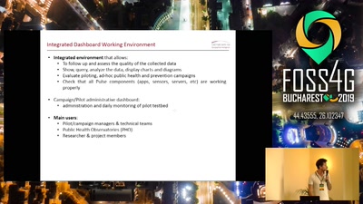
The case of PULSE: fostering sustainable environments using geodata with a participatory…
General
26 min
2019-08-30
19
Andrea Pogliaghi
FOSS4G 2019
13 min
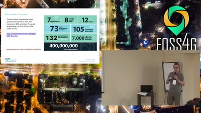
GEO 101 - an intro to the Group on Earth Observations (GEO). GEOGLOWS: EO and global…
General
13 min
2019-08-30
26
Julia Wagemann
and
Steven Ramage
FOSS4G 2019
25 min
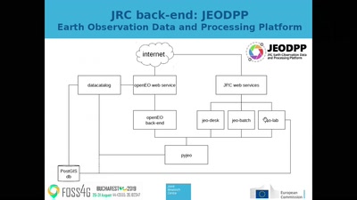
Implementing an openEO compliant back-end for processing data cubes on the JEODPP
General
25 min
2019-08-30
44
Pieter Kempeneers
FOSS4G 2019
24 min
The European Union's Copernicus program: Europe's eyes on Earth
Keynote
24 min
2019-08-30
98
Francesco Barbato
FOSS4G 2019
20 min
How to make a crafty Vector Tile map: Custom tiles, the perfect sprite, animating stuff…
General
20 min
2019-08-30
175
Niene Boeijen
FOSS4G 2019
18 min
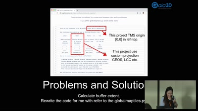
VectorTile for SeaWind
General
18 min
2019-08-30
37
YeonHwa Jeong
FOSS4G 2019
26 min
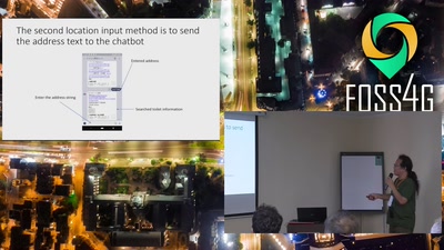
Development of a public toilet search system using open data and chatbots
26 min
2019-08-30
32
Yoichi Kayama
FOSS4G 2019
25 min
Building FOSS4G friendly ecosystem in Central Europe
General
25 min
2019-08-30
31
Jáchym Čepický
FOSS4G 2019
14 min
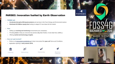
e-shape and PARSEC: Copernicus enabled business opportunities
General
14 min
2019-08-30
19
Valentina Balcan
FOSS4G 2019
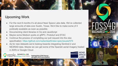
24 min
How to host and access STAC Imagery using Google's gRPC Remote Procedure Call framework…
General
24 min
2019-08-30
52
David Raleigh
FOSS4G 2019
27 min
What's new in PostGIS
General
27 min
2019-08-30
539
Darafei Praliaskouski
FOSS4G 2019
22 min
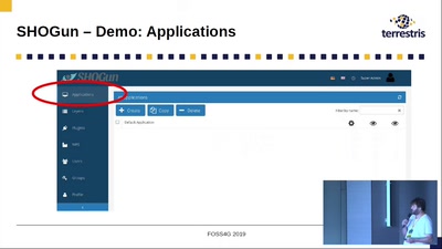
SHOGun, GeoServer & QGIS Integration: Manage WebGIS Applications from your Desktop
General
22 min
2019-08-30
328
Till Adams
FOSS4G 2019
30 min
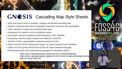
GNOSIS Cartographic Map Style Sheets (CMSS) - an elegant and powerful styling language…
General
30 min
2019-08-30
38
Jerome St-Louis
FOSS4G 2019
28 min
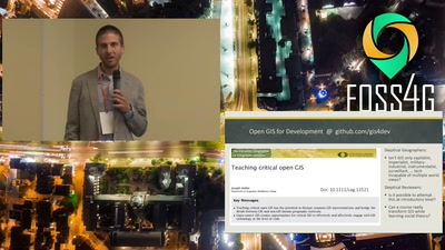
Human Geography with Open GIS as a Transformative Introductory Higher Education Course
Academic
28 min
2019-08-30
35
Joseph Holler
FOSS4G 2019
26 min
Using a QGIS for small scale agriculture mapping
General
26 min
2019-08-30
576
Tim Sutton
FOSS4G 2019
19 min
National Forest Inventory (NFI) in the Czech Republic presented in Graphs and Maps
General
19 min
2019-08-30
44
Vendula Hejlová
FOSS4G 2019
14 min
Case Study of Data Collection & Data Sharing for Rural Water Supply Management in Rwanda
General
14 min
2019-08-30
341
Larissa Dusabe
and
Jin Igarashi
FOSS4G 2019
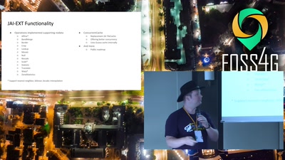
20 min
State of JAI
General
20 min
2019-08-30
82
Jody Garnett
and
Andrea Aime
FOSS4G 2019
13 min
Four-letter word
Keynote
13 min
2019-08-30
548
Iván Sánchez Ortega
FOSS4G 2019
25 min
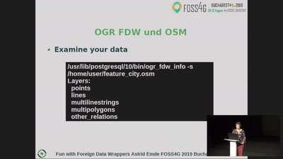
Fun with Foreign Data Wrappers (FDW) and PostgreSQL
25 min
2019-08-30
893
Astrid Emde
FOSS4G 2019
22 min
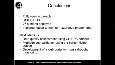
An open drought monitoring system for the Deduru Oya basin in Sri Lanka in the context of…
Academic
22 min
2019-08-30
28
Bopagoda Hettiarachchige Sudantha
,
Rangajeewa Ratnayake
,
Emeshi Warusavitharana
,
Daniele Strigaro
and
Massimiliano Cannata
FOSS4G 2019
8 min
(G)EO hackathon: engaging indigenous communities
General
8 min
2019-08-30
20
Diana Mastracci
FOSS4G 2019
16 min
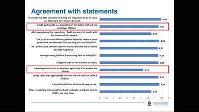
Evaluating student motivation and productivity during mapathons
Academic
16 min
2019-08-30
14
Victoria Rautenbach
,
Cameron Green
and
Serena Coetzee
FOSS4G 2019
21 min
Building a national vector tile set for the Netherlands
General
21 min
2019-08-30
124
Steven Ottens
FOSS4G 2019
previous page
next page